 As mentioned in my last Post from Yabucoa, I am exploring the southeast coast in more detail. Thanx to Tony, we were able to hang around a couple extra days.
Hwys 3 & 901 along the coast between Patillas and Yabucoa.
 Highway 3 (and Hwy 901) has to be one of the most beautiful drives on the entire island.
It is mentioned in several travel guides as a ‘Must See’. It meanders along the coast sometimes running up the mountain to avoid the sheer cliffs below, then back down to the shoreline. It is peppered with weekend bars and restaurants of all kinds
 Highway 3 is very old… I have maps that show it dating back to before 1898.
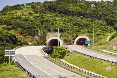
The faster Hwy 53 is not finished in this area so Hwy 901 is what links the east coast with the south coast. Road construction on the Maunabo side takes you through a new tunnel that dumps out onto Hwy 901. Reminds me of the so-called ‘Bridge to Nowhere’ they wanted to build outside of Juneau, Alaska. I know it will eventually hook-up with Hwy 53 near Yabucoa, but it still looks kind of funny.
Because Hwy 3 and Hwy 901 skirts the shoreline, there are several public beaches along the way. We checked out 4 of them including the Punta Tuna Lighthouse.
 I need to pause here and apologize regarding my misconception about the many beaches of PR. When planning my first trip to Puerto Rico, I dismissed the beaches as something on a par with Golf and Health Spas.
I was wrong.
Yes, there are ritzy private beaches, but there are many more public beaches and they are great! Only a few require any kind of cover charge to visit. The Public Beaches are akin to your typical picnic rest stop. They range from little more than a pull off area in the dirt to formal concrete covered tables with restrooms and shower facilities. There are concerns about security, but as long as there are some locals about, you should be safe. Always be vigilant.
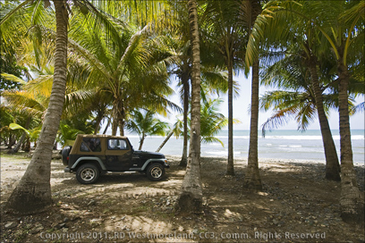
 “I can see myself sitting in a camp chair, umbrella overhead, sipping a cold one from the cooler while listening to the local FM station belt out some upbeat Latin rhythm.. as the cool shore breeze washes over my face… in February.”
 Exactly like the Corona beer commercial.. exactly.
The 4 beaches we looked at were very different from each other so they represent a good cross section of what to expect. Just know, like going on a picnic, you need to bring everything you need with you.
One of the first stops I made after arriving in Puerto Rico was to score a cheap styrofoam cooler for road trips.
On the Road…
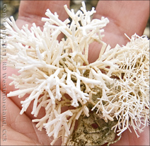
Since we were coming from the Ponce side of the island, we took Hwy 52 to Hwy 53, then Hwy 3 out past Arroyo. Our first stop was at a small roadside pull-off with the beach right at the highway. Several locals were already set up for the day with coolers, folding chairs and umbrellas. 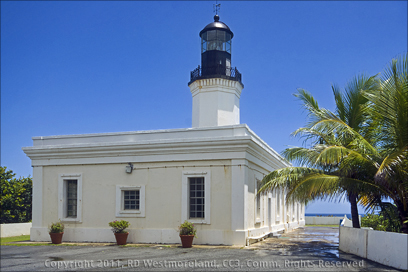 All before noon. The shoreline here was a little rocky with some sand so there was not a lot of folks playing in the choppy surf. What it did have was lots of Palms overhead, protecting you from the sun. We found an assortment of dead coral and sea shells and crabs darting into the water. There was also a lot of non-destructible plastic crap mixed into the shoreline driftwood.
Note/Correction: Highway 3, as you approach Maunabo, vears North and heads over the mountains to Yabucoa. To continue along the coast, you need to get on Hwy 901. It continues onto Yabucoa as well. Thanx Fran and Steve for the ‘heads-up’.
PLEASE take out your trash when you leave. Enough said.
 Our 2nd stop was the Faro Punta Tuna (lighthouse) and grounds
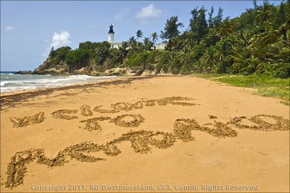
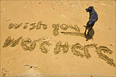
This is the most picturesque lighthouse and beach I have come across to date. It truly is postcard material. I had been wanting to write something in the sand, ever since I got here and this was it! The lighthouse itself is accessible from Hwy 760 or Hwy 7760 off Hwy 901, depending on the direction you are coming from. The Puerto Rican highway map I use shows the lighthouse, but it’s not labeled. It falls within the Municipio of Maunabo, but it’s a short run to Yabucoa.
 Access to the grounds is free and open from 9AM to 3:30PM, Wednesday – Sunday.
The grounds keeper was very polite and readily answered all our questions, but was really only fluent in Spanish.
We signed the guest book and took the short hike up the nicely paved path to the lighthouse.
At this point I could see a squall rolling in from the ocean.
We took refuge in an old concrete structure next to the lighthouse as it went by. Then 15 minutes later, clear skies! The lighthouse was, from what I could tell, perfectly restored. 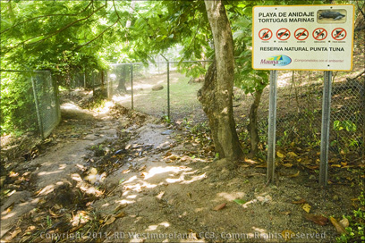 It looks identical to the one laying in ruins near Guanica.
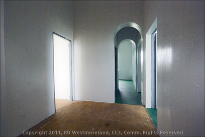
Since the building was locked up tight, my only interior shot was through a dark window. Would love to get access sometime to really do it justice.
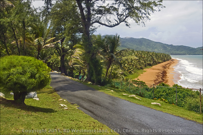
The shot of the paved path, shows Turtle Beach below and where the other shots were taken from.
We walked back down to the caretakers office which also housed a small museum and public restrooms. I should also note that there were benches strategically located on the grounds as well.

The Museum is free so I popped in to check it out…
It’s quite small and has a collection of artifacts and trivia from the local area. Of note were several lighthouse paintings and old black and white photos.
 After that, we said our goodbyes and shuffled on. The parking area is little more than a paved spot to turn around and go back. It might accommodate 4 cars.
Off the parking lot is access down to the beach.
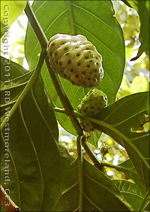
As can be seen in the shot, the first 100 feet is pretty rugged having been washed out by local rains. After that though, it is easy going. The beach is only about 500 feet from the parking area. Something strange- we found Noni growing wild along the path. Some were bearing fruit!
 The path eventually opens onto the beach with a spectacular view of the lighthouse above.
 It is truly a grand site. I walked down the beach a ways hoping to spot a sea turtle, but no luck.
Though the beach is open to the public (like you could keep them out), it is part of a sea turtle reserve. Turtles from the Caribbean and Atlantic come to lay eggs here.
The beach was scattered with driftwood and more plastic debris. I did pull a plastic jug out of the view for the shot of the lighthouse above. The beach next to the lighthouse was very rocky, but sandy farther down.
 We passed a pair of warning signs on the way down to the beach about the presence of strong currents and that this area was off limits to swimming.
There is a more formal entrance to the Turtle Beach Reserve down farther, off Hwy 7760.
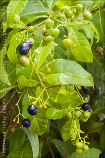
The sign sez it is open from 8AM to 5PM. I assume, 7 days a week since it did not list days open. There is a grassy parking lot big enough to accommodate a dozen cars or more. We had checked it out earlier, but since no one was there yet, we did not stick around. I did spot Sea Grapes and a berry that somewhat resembled Blueberries growing off the parking lot. I saved some of the ‘Blueberries’ so I could identify them later.

The shots from the beach were done the last day of our trip to Yabucoa so I was running out of camera battery at that point. I had brought 2 freshly charged batteries, but forgot the charger. Just as we were about to leave the beach, my camera finally died. Me First Mate got shots of tiny little Hermit Crabs darting under the Noni trees.

 The Punta Tuna Lighthouse and beach definitely rates 5 Skulls!
The 3rd public beach we visited is down near the port of Yabucoa.
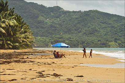
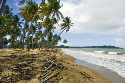
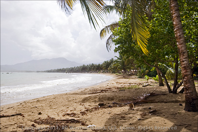
You can access it via Hwy 9914 off Hwy 3. The port is to your left if you are facing the ocean. There are no facilities here, but it lends itself to group BBQ’s and family picnics. Lots of little pullouts to park in, most with a view of the ocean. Lots of Palm trees for cover. Down by the shoreline was tons of bamboo driftwood and new coconuts sprouting up. There was also lots of plastic debris too… kind of hard to avoid. This would still be a great spot to kick back for the day.
 The 4th and last beach I visited was at Punta Guayanes on Hwy 906, off Hwy 53.
 Take the exit at Aguacate.
This beachside community was a very nice surprise.
The public area had concrete picnic shelters, public restrooms and outdoor showers with a large paved parking lot.
It was well maintained with a minimum of garbage about. The beach had the least amount of plastic debris of the 4 we visited. Very nice.
 The 4 beaches we checked out were not all the beaches in the area.
In particular, I did not get shots in the ‘Reserva Natural Punta Yeguas’. Maybe another time.
If you need to kick back down by the beach when in Yabucoa, there are lots of places to check out. Don’t forget the Punto Tuna Lighthouse… it’s breathtaking.
Next up- the Central Roig abandoned sugar mill of Yabucoa.
A special thanx to me First Mate for using a few of her shots… Arrg!
Fran and Steve says
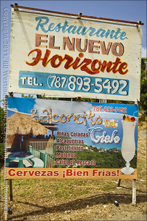
The Punta Tuna lighthouse is actually in Maunabo, as are the beaches on either side of it. The Maunabo tunnel is considered part of the incomplete PR53 project, but at the moment, the tunnel is accessed from PR 901, which connects Yabucoa to Maunabo (in addition to the PR3, which is another route that crosses over the mountains between the towns). The 901 continues on to Maunabo, from which you would access 7760 to the lighthouse. The 901 is the road that follows the mountain coastline, and in my opinion, the drive on 901 between Yabucoa and Maunabo (passing El Nuevo Horizonte along the way) is the most beautiful on the island. I hope you were able to enjoy Maunabo’s annual crab festival on Labor Day weekend! – Fran