Balneario Punta Salinas
A nice little park for relaxing on the weekend or whenever.
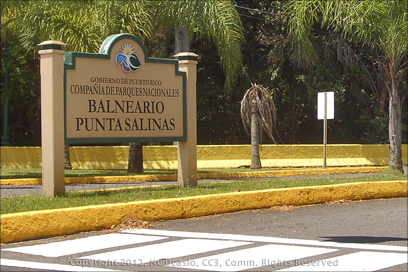 Continuing with my exploration of the North shore, we made a quick run into Balneario Punta Salinas. It’s off Highway 165 at Highway 868. There’s a formal entrance that’s hard to miss. Blvd. de Levitown is on the opposite side of Hwy 165. This park is run by the same group that manages Isla de Cabras, Compania de Parques Nacionales. If I lived near by, I could see me coming here on the weekends to kick back and relax. It’s a popular place.
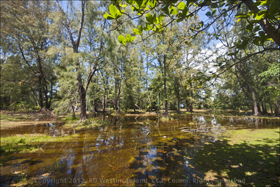 Think of this recreational area as a smaller, more laid back version of the one at Isla de Cabras.
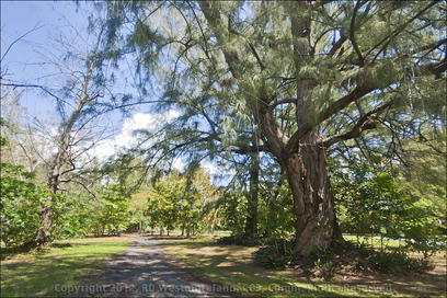
Once you leave Hwy 165, you pass through a forest of very tall wispy pines. These are old growth trees in a somewhat swampy area. Kind of reminds me of the bayous in Louisiana near where I used to live in East Texas. I have seedling starts of these same pine trees.
Moving on through this area to the main parking lot of Bahia de Toa, you could see folks spread out along the bay facing the Atlantic Ocean. Definitely one of the nicer beaches in Puerto Rico. It’s postcard perfect here.
Military Significance
The pair of tiny islands that make up the peninsula of Punta Salinas have been called many things over the years.
 The Spanish built a small fortification here in 1797 on what they called Isla Bateria, ‘Battery Island’. The remains of Fort Castro were last noted in a 1937 survey by the US Army.
It even had a
drawbridge and dry moat.
After the US took over PR, there was a WW II bunker constructed around 1941. That was named Fort Mascaro and operated as a garrison of Fort Buchanan. Seems they were a little worried about German U-boat traffic. It was largely abandoned by 1950.
 Currently, there is an active Radome site so you cannot access those parts of the point.
It’s still a nice place to check out.. sip a beer, soak up some sun or play in the water. You did remember to bring the cooler, iPod, folding chairs and a beach umbrella, right? There are park maintained restrooms too.
Back to Highway 165
Heading west down Hwy 165, there are several more places to pull off the road to access the beach. Yes, these are not maintained like the two previous parks and security is probably an issue. OK I guess for large families or groups.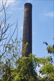
There are lots of almond trees lining this 1.5 mile portion of 165. Something you don’t see much of back in the States. There are also several local bars and eateries along the route worth checking out so you don’t have to go thirsty or hungry. After this, 165 takes a long loop and heads south, away from the coast.  The next major intersection is at Calle Méndez Vigo which will take you into Dorado.
I’ll be addressing Dorado in my next post, but we headed on down 165 to the little town of Toa Baja.
Sugar Mill Country..
From the road, just before we got into Toa Baja, I could see another sugar mill chimney sticking out above everything else. It’s opposite a US Post Office and to the back of another business. Digging through my collection of material from the Historic American Engineering Record, I was able to identify it as the abandoned Constancia Sugar Central. You can make out part of the name on the chimney. This Central dates to 1897.
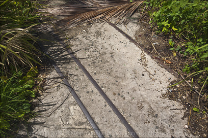
We stopped long enough for me to make a brief inspection, but it was too overgrown to really check it out. A length of old train rail is imbedded in the concrete so that helps to date it. I will be back sometime.
On Into Toa Baja
Toa Baja was founded in 1745 making it one of the older settlements in Puerto Rico.
It was the original site of the ‘Kings Farm’, established by Juan Ponce de Leon. It currently has about 89,600 residents. The area is dependent upon manufacturing (and to a lesser extent, agriculture) for it’s income.
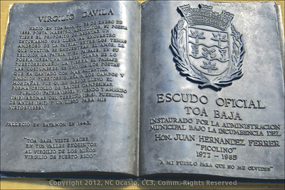 It should be said, sugarcane has not been grown here since the mid-1970’s.
In 2009, squatters at Villas de Sol had their water and power shut off by Governor Luis G. Fortuno since it was in a flood-prone plain. The Feds bought some of these homes to prevent them from being used again. PR is in the process of demolishing some of them. Many Dominican illegals had made this their home.
The seasonal flooding of this area is what eventually lead to the founding of Dorado. Many locals got tired of rebuilding their homes every few years.
The plaza of Toa Baja is small, but nice and well kept.
The Catholic church, dedicated to the Apostle San Pedro sits just off the plaza. The plaza features the Mayors Office (Alcaldia) a couple of restaurants and several homes. We were there mid-afternoon so there was no one out yet.
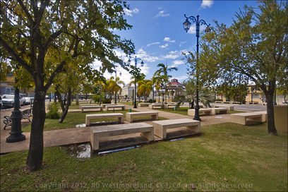 It almost had the feel of an abandoned town.
I did like the fact that there were lots of park benches scattered across the plaza with shade trees and palms strategically placed.
It had rained pretty hard during the last few days so there was standing water in a few spots.
Another plaza feature is the extensive use of classically styled street lights. I’m sure it’s quite impressive at night.
A nice public space, all in all.
Larger images from this post may be seen on RobertosPuertoRico FB Page.
Note: The sugar mill and military history were courtesy of data collected by the Historic American Engineering Record.. part of the US National Park Service. Info about Toa Baja was taken from Wikipedia and the Puerto Rico Encyclopedia.
Since we still had a couple more stops to make, we headed back up Hwy 165 to Dorado. I’m saving that one for my next post.
L8r, Roberto


Leave a Reply