 As most of you know, photographing the old sugar mill ruins of Puerto Rico is one of my most favorite things to do. Especially now that I have a pretty decent camera.
Well… Santa Elena is by far, the best site I’ve been to yet.
I stumbled onto this place while studying a collection of material I downloaded from a Department of Interior’s Website. It is host to the American Engineering Record archives which is part of the (US) National Park Service. 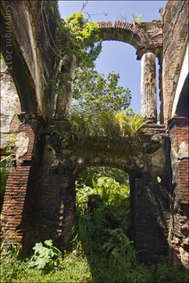 The main list simply breaks down by the State 2 letter postal ID. I downloaded almost everything under ‘PR’. It turned out to be a treasure-trove of images, drawings, maps and data.
All of it is available to the public at large… Your tax dollars at work!
Other than giving credit where credit is due, you are pretty much free to use the material as well. So I will be featuring bits and pieces of it that complement the story, just as I did when I featured Isla de Cabras a few weeks back.
If this interests you, you might want to check out the National Register of Historic Places listings in Puerto Rico found on Wikipedia. It’s a great place to start.
General Observations
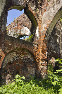
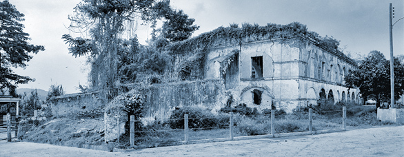
As you can see in the old wide shot, there was a time when you could walk around the grounds to photograph it. Today, there is a chain link fence right up next to the ruins. 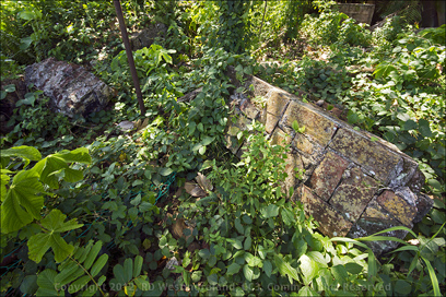 The floor of the old hacienda was covered in trailing undergrowth. This actually made for very interesting images, but it meant I had to watch every step I took.
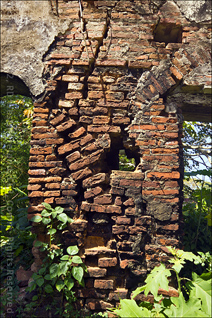
Yes, the building is in a state of serious deterioration. It is not a structure that could be restored… it’s too far gone.
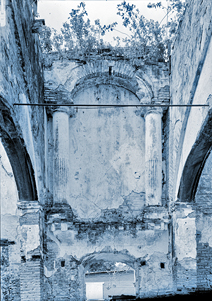
A large section of the North Wall had recently collapsed and taken out part of the chain link fence. It happened awhile back as there was overgrowth covering all but a small part of it. 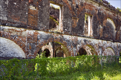 You can see the wall is still standing in the shots taken by Mr. Boucher.
Those were shot in about 1977 or ’78.
I speculate that the earthquakes we experienced back on December 24th of 2010 and December 17th of 2011 brought down part of the North wall.
They were both over 5.2 on the Richter scale and lasted several minutes each. More than enough time to cause this type damage.
None of these walls display any metal rebar reinforcement.
If you take a look at the larger images over on Roberto’s Puerto Rico Facebook Page, you can see where several of the walls have huge cracks running through them.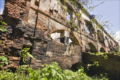
Historically Speaking
Hacienda Azucarera Santa Elena was a sugar mill that operated from 1790 to 1910. It was spread across 500 acres. This would have been a colossal building for the period. The mill originally sheltered an ox driven, vertical cane crusher made of wood. The building underwent ‘improvements’ over the years, the most dramatic being the addition of cast iron support columns.
The columns are ornate, but very functional.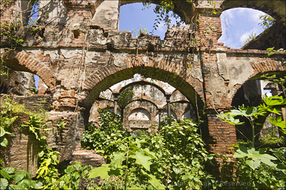
In the late 1820’s or early 1830’s steam power replaced the oxen.
At it’s peak, it had a five-vat Jamaican train with twelve crystalizers. I’m not sure what that is, but it sounds good.
It was quite advanced for the period, but by the time it closed in 1910, it was past it’s prime. At one point there was even a rum distillery on the property. Just prior to World War 1, all of the heavy equipment was sold off as scrap. The end of an era.
The Plan
I had previously studied the shots by Jack Boucher had done, so I knew what to look for. BTW– Back when he did his work, 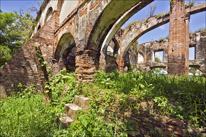 it was all done from a 4×5 view camera using orthochromatic black & white film.
I admire the effort that went into the huge archive of images he produced.
I’ve shot with 4×5’s and it takes practice to get good at it.
Once I found the hacienda on GoogleMaps, I plotted how to approach the structure… from an open pasture, North of the ruins. It was an easy 5 minute walk.
I did not discover until my exit that the grounds were posted.
 The ruins stand next to a fairly modern dairy processing facility, but it appeared to be shuttered.
 No one was there… no caretaker to be seen.
Photo Details
All of my shots were done with an NEX-7 and a Sigma 10mm-20mm zoom, manually focused at F8 or F11.
And I always shoot from a monopod. A little bit of chromatic aberration was corrected in Photoshop as well as some perspective correction and shadow/highlight adjustments.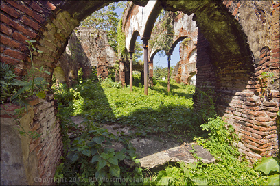
Because it was such a large structure, it took a wide view to capture all of it.
As mentioned earlier, many more shots and much larger ones can be seen over on Roberto’s Puerto Rico Facebook page.
If you like what you see, please ‘like’ it.
It was fun!
In conclusion, I consider Hacienda Santa Elena, the ‘shoot of a lifetime’.
I feel blessed.

Julie says
Hi. First of all, thank you for the beautiful pictures and the useful information. I’m currently doing a historic investigation of this Hacienda. I was wondering if there is anyway to get in contact with Jim Hughes. His testimony would be very helpful. Thank you
Jim Hughes says
According to my family’s history, my grandmother was born and lived at Santa Elena. Her father’s name was Risueno, her mother’ Rijos. The property was called “Half Moon” and was sold to the Fonelledas family, current owners of Tres Monjitas dairy. (S. Dog- Thank you for the details. Info like this is always appreciated. ARRG!)
Karen says
Hi Roberto. I live in Toa Baja and I’d never seen Santa Elena. I want to see it with my own eyes. Where exactly is located? I’m trying to find it with Google Earth but there is nothing that I can recognize as the hacienda. Thanks in advance. (S.Dog- Here are the Latitude and Longitude numbers for the ruins: 18.4304181, -66.257574. There is a dairy farm there too.)
Ellie Parker Sapia says
Hello! I just stumbled upon your website in my search for a city map of my hometown Ponce in the early 1900s. I’m enjoying your website very much! I’ve written an historic novel based on the life of my grandmother from the Playa de Ponce and it was sent to my CA editor today! I believe in synchronicity, so I wanted to say hello and wonder if you could steer me in the right direction for a detailed map. Thanks in advance! (S.Dog- I do not have any maps of Ponce, but you might find something over on the Library of Congress Website. That is where I got most of my maps. There is a link to them on my Maps Page.)