Or, Shopping in Ponce & the Slow Road Home
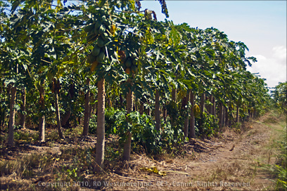 The area along the south coast between Ponce and Salinas is very relaxed. Not many tourists make it out this way. Highway 1 meanders near the coast, sometimes right up by the beach. If you have the time, I really recommend it. It stretches from Guayama in the southeast, all the way to Ponce. I’ve done it several times now. The area is primarily agriculture. Papaya, banana and palm groves are spread out all over this region.
Remnants of the old sugar mills are everywhere.
 (Part 4, the Old Sugar Mills &
Plantations of PR, revisited)
This used to be prime sugarcane country until the market finally collapsed in the early 70’s. Remnants of the old irrigation system can be seen from the road. Aguirre, which I reported on before, is situated east of Salinas which is east of Santa Isabel. 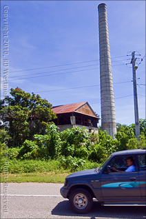 There are lots of little open-air bars and Pincho stands along the route, though some are only open on the weekends. If you were coming from San Juan, then you would get off Highway 52 at the Santa Isabel/ Coamo exit and head towards the coast. It will eventually connect with Hwy 1. Coamo is obviously in the opposite direction. There is a Walmart and several fast-food shops on this exit as well, but I prefer Pinchos if I can find them.
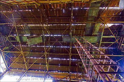
I discover something new, every time I make the run along Hwy 1. The ‘ruins’ in this set are much larger than they appear from the outside. The chimney was at least 20 feet in diameter at its base and could be seen for miles off. It’s what caught my eye. The building immediately next to it was over 40 feet tall and over 100 feet long. 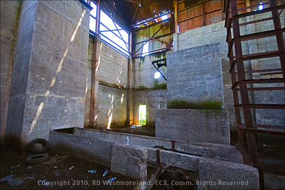 It’s a concrete and steel structure, not red brick and stone like many of the others.. so it came late to the sugarcane agriculture effort. Birds and paper wasps have made it their home for quite some time now. It was a real effort to hack through the undergrowth just to get a peek inside. This place is situated in an area called ‘Descalabrado’, between Ponce and Santa Isabel.
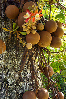
 We stumbled onto a tree near the ruins I had not seen before (like that never happens to me). It had the strangest looking fruit hanging from it and was in the process of shedding its leaves. Its well over 50 feet tall. I contacted a new acquaintance who runs a kind of experimental tropical fruit farm near Mayaguez and he said it was called ‘Cannonball’ because the fruits were so round and large. He stated that it was toxic, stank when ripe and leaves a nasty stain if handled. Glad I didn’t touch any of it. DOH! Now I know why it was covered in fruit… no one will mess with it.
  The botanical name for it is Couroupita guianensis/ Lecythidaceae. Sadhu also grows Bamboo so we have a trip planned to check out his place sometime in December or January. He even has a book he wrote about his effort. More later, I promise.
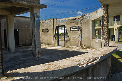
Most of the Santa Isabel sprawl is up by the main exit on Hwy 52. The area along the coast is older and somewhat rundown. There is a nice pull-off area to sit and watch the surf with several bars immediately behind you. As typical of the area, an unfinished restaurant lay in ruins to the right. Locals were using it to hang out and gossip. 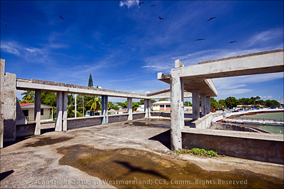 I took the flight of stairs to the top floor for a pretty good view of the small harbor. The shot of the birds overhead was actually a composite image created in Photoshop. The shadow in the foreground is real… I did not fake it. The concrete dock out front of the pull-off was in ruins and was chained up so you could not go out on it. In fairness, it did not look safe… rusted rebar was sticking out of it at odd angles. Very dangerous. This area is prime for some serious renovation work.
On the upside, Santa Isabel is about to become the home of an ‘Eco Farm Plantation’. Billed as the “world’s 1st wind and solar powered aquaponic vertical farm”. There is a slide show with graphics about their plans. I will be reporting on it in a future article as well.
L8r, Roberto, the Scurvy Dog


Leave a Reply