 This story concludes our one day mega-run through the northwest shore of Puerto Rico. A marathon day, we do not intend to repeat.
 My feet were killing me by the time we finished.
We started with Isabela, then moved on to Quebradillas and Camuy.
Each town had its own unique flavor.
Hatillo is situated on the coast, east of Camuy and west of Arecibo.
Hatillo has a population of about 42,000 people. It was founded in 1823 by Don Agustín Ruiz Miranda, an immigrant from the Canary Islands. Its primary source of revenue comes from dairy products and Hatillo supplies PR with about 1/3 of all milk consumed on the island.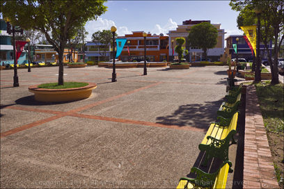
Since we were coming from Camuy, we took Highway 119 instead of Highway 2. Either of these will get you there. Highway 119, which becomes Avenue Drive Susoni, took us to within a block of the plaza where we found parking.
The plaza is a large open space, peppered with a variety of trees and bordered by a short wall with colorful park benches running to the inside of it. There are also series of old fashioned street lights spread across the plaza. I bet the plaza looks real nice when lit up.
 It was a very clean, neat space.
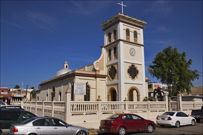
The mission style Catholic church sets off the plaza to the east behind a formal fence and courtyard.
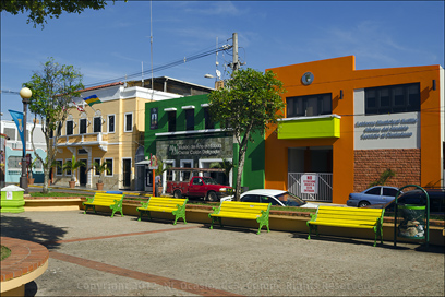
The Alcaldia or Mayor’s Office as well as the local museum are situated to the south.
These were painted in bright colors.
The Tourism office is also located off the plaza to the west, but we did not go in. It was getting late.
One last building worth mentioning, Hatillo has a public library, a ‘Biblioteca Municipal’. This may not seem like a big deal for folks from the mainland, but most towns in PR do not have libraries. 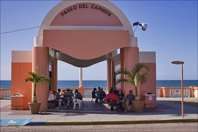 Where I live in Coamo, there is no public library.
I discovered this fact on my first trip to the island.
Lots of baseball and and basketball courts, but no libraries.
Hatillo is to be
commended for having one!!!
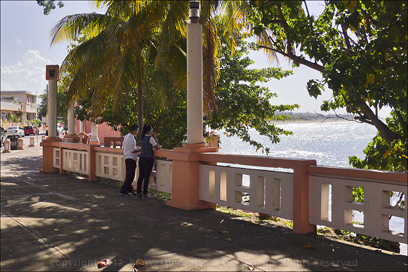
About 2 blocks north of the plaza is the shoreline and a wonderful public space with a dramatic view of the Atlantic ocean.
Paseo del Carmen is primarily a concrete boardwalk with a formal covered space and lots of shade trees on the east end of it. If you follow Calle Manuel Lacomba (street) for another block, it connects to a small park. 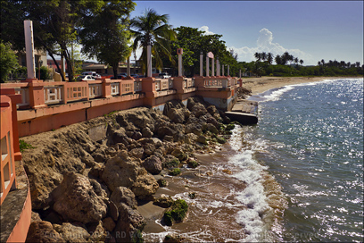 I did not make it over to that since my feet were killing me.
Something I found odd, most shots on GoogleMaps show a sandy beach directly off the boardwalk, but I saw mostly bare rock, right up to the boardwalk wall. As if the ocean had washed most of it away. Maybe they plan to bring in more fill… I don’t know. Further on down, west of the boardwalk, there is some open beach. Many shots also reference a Marina, but I did not see one.
I also scored 2 more avocados, ‘aguacates’ for 50 cents each, from an older gentleman down by the boardwalk. They were awesome!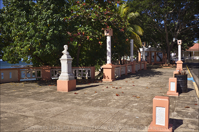
I think Hatillo would be a great place to kick back and relax, if you were looking for some privacy.
No, we did not get to hit all the places we wanted to see in one day. My goal was to visit the plazas of each town and I did manage to do that.
We got back on Highway 2, to go home via Mayaguez and Ponce around 6:30PM. You would think that would be a pretty quick run, but you would be mistaken.
There were no less than 61 stop-lights on Highway 2, between Hatillo and our place in Coamo. 46 of those were before we drove through Mayaguez.
 This part of Highway 2 is very stop and go.
Especially if you get caught up in local rush-hour traffic which is almost impossible to avoid. It took 2 hours, 20 minutes to cover that 75 mile stretch.
But HEY! I live on the Isle of Paradise.. beat that!
As always, there are more and much larger shots over on me FaceBook page. If you like what you see, please ‘like’ the page. Thanx, the Scurvy Dog
Leave a Reply