 As mentioned in my last post on Santurce Graffiti, this is part 2 of a Photo MeetUp shoot we did a few weeks back. After having covered the Street Art of the area,
 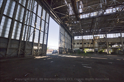 we moved over to the Isla Grande area which is also part of Santurce.
Isla Grande-
Isla Grande is also very close to Old San Juan and had been used by the Spanish military, very early on.
Though Isla Grande was originally an island, it and the surrounding mangrove swamps were filled in to accommodate the construction of the WWII San Juan Naval Air Station.
Prior to WWII and the arrival of the US Navy, it was the home of Puerto Rico’s first international airport operated by Pan American Airways. Later, after the exit of the Navy, the Air National Guard would work from the same airstrip. 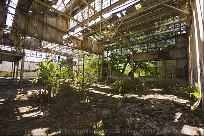 Small aircraft still fly in and out of it, but FAA suspended tower services a couple years ago.
A buddy of mine used to work there.
The Photo MeetUp group stopped briefly at an old Navy hanger to get some ground shots. It’s featured in a photo on Wikipedia. It was a huge structure with several smaller buildings next to it. One had become home to several bats. Abandoned metal buildings like this pepper the Puerto Rican countryside.
Then we moved onto the main event.
The Ruins of the Miraflores Powder Magazine-
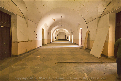
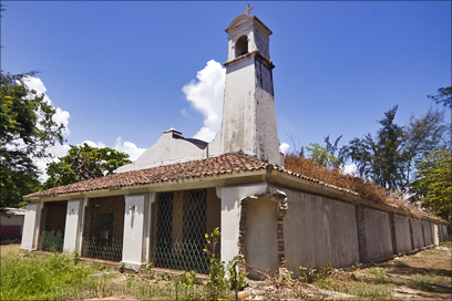 As is typical of a Photo MeetUp, we were exploring things, some of us had not seen before. That’s part of what makes it so much fun. What we discovered on our little trek was one of the oldest buildings in all of Santurce.
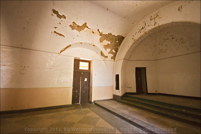
There was a chapel on the grounds as well a several other buildings, but it seemed odd that the structure had a guard post built into one corner. Just like you see so famously featured in El Morro photos. It was definitely very old.
It took some digging, but I did discover what the deal is.
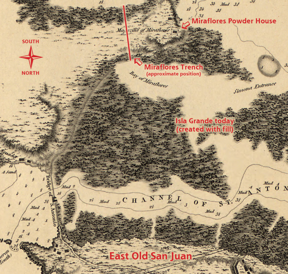
As can be seen on the 1794 map below, the Miraflores Powder House was already a fixture of the period.
 Sometime after 1765, plans were set to build 5 new black powder magazines. The Miraflores Magazine was built in 1776 (or 1770 depending on the source). For safety’s sake, magazines like these were spread out to minimize casualties if one blew up. Very dangerous stuff.
 It served the Spanish military until 1898 when the US took possession.
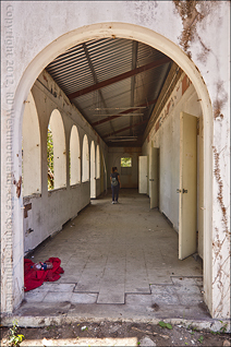
At this point, the US converted the powder house into a processing and quarantine center run by the US Public Health Service. This was done to accommodate the processing of immigrants arriving by boat. It ran from 1899 until the 1930’s.
In 1943, the powder magazine was repurposed again.
This time it was made into a chapel (the Santa Barbara Chapel) for the new Isla Grande Naval Base. The chimney at the front was converted into a bell tower. A roof and side walls were added to the buttress reinforcements on either side of the building almost doubling it’s floor space.
In 1971, with the closure of the Naval Base, ownership passed to the Institute of Puerto Rican Culture where it became the headquarters of the San Juan Ballet and San Juan Children’s Choir. Later, it passed to the Dept. of Transportation and Public Works.
In 1984 the Miraflores Powder Magazine was added to the US Dept. of Interior’s Nat. Registry of Historic Places, even though the structure has been heavily modified over the years.
There was another discovery worth mentioning…
A most helpful 28 page PDF by Bonnie Donohue, dedicated to the early history of the Miraflores Island and the development of the US Naval Base that followed. Yes… at one point it was an island due to the fact that the Spanish cut a channel through the swampy mangroves, separating it from the mainland in about 1805. I’m glossing over the details, but I found Bonnie’s research most revealing.
Her documentation was very thorough.
Wikipedia was devoid of any additional info, but it did list the Lat. and Long. numbers for the Miraflores site.
Sadly, I found no reference to the powder magazine in my collection of Historic American Building Survey material, conducted by the Dept. of Interior in the late 1970’s.
I managed to find one black and white postcard over on Flikr that featured the front of the Miraflores Chapel remodel. You can just make out one of the guard stations on it’s right corner. Here’s a link to the Flikr image.
A Nice Old British Map from 1794-
In the process of trying to track down some history about this location, I re-searched the Puerto Rican maps archive over on the Library of Congress Website.
I got lucky!
The map presented above is a very tight crop of a larger crop from a much larger file.
Got all that? Yes, there are 3 versions.
The larger ‘cropped’ map with more notes in red can be seen, over on my Roberto’s Puerto Rico Facebook page. If you are interested, you can see the original map I worked from, over on the MAPS page via the tab at the top. It’s an 1805 English adaption of a survey done in 1794 by the Spanish Navy.
 Hence the use of ‘Porto’ instead of Puerto.
It’s worth noting that this naval map is drawn ‘upside-down’ so a captain entering the San Juan Bay would not have to ‘flip it around’ to use it.
Today-
Now, the grounds have become the resting home for old government vehicles. The Miraflores Powder Magazine sits abandoned after 235 years of service. A testament to a time gone by.
There is much, much more to Santurce… I will be back.
As always, larger images and the larger cropped map may be seen over on Roberto’s Puerto Rico Facebook page.

Leave a Reply