 On to Quebradillas from Isabela..
This is part 2 of a 4 part series regarding the towns of the northwest coast of PR. Our first stop was Isabela. We left off by covering the old train tunnel where Rio Guajataca empties into the Atlantic Ocean.  Though the tunnel and beach are on the Isabela side of the river, it’s actually much closer to Quebradillas.
On the Quebradillas side of the Guajataca River is a beautiful Parador with gorgeous views of the Atlantic Coast. We did not stop to check it out.
A word or two About Puerto Rico’s Paradores
Paradores are as close to Motels as ‘mainlanders’ will ever get, here on the island. There ARE a few motels, but they are used by the locals for ‘quickie getaways’. Paradores are more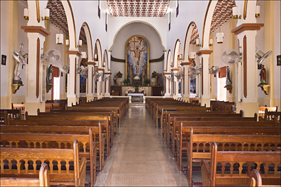 like country Inns with a tropical twist and can vary in size from quaint to massive. Many of them have pools, bars and restaurants.
They are privately owned, but must meet a certain set of requirements to receive Parador certification by the Government of Puerto Rico.
If you visit the See Puerto Rico Website’s Accommodations page, you may click on the Paradores category to see where some are located. All are outside of San Juan with most located on the west end of the island. 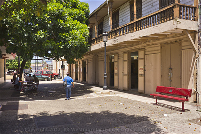 Coamo has one that was recently remodeled and is very popular because of it’s natural hot springs.
There are many more small Inns, but Paradores have the blessing of the PR Government.
Back to the trip…
Our trip continues along Highway 2 which will take you past Quebradillas. There is a well marked exit into Quebradillas proper, which took us directly to the Plaza.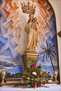
Quebradillas is a small town by island standards with a net population of about 26,000. It was founded in 1823.
They also take their basketball, quite seriously.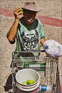
The Plaza and Catholic Church of Quebradillas is as classic Puerto Rico as you can get. A model of old Spanish living.
It was gorgeous!
Especially the church which was open, so we took a respectful walk through it. Like I said, it was classical. The only departure  from detail was the collection of mounted electric fans. Not a big deal. After all, it IS a functioning church, not a museum.
From the church, we strolled over to the formal stage area of the plaza to get shots of the church and sculpted shade trees. 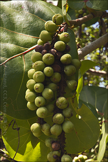 I was approached by a guy selling large avocados, ‘Aguacate’ for 50 cents each. We scored only 2 since our avocado tree was about to give up a bunch.
Just off the plaza is a 2 block stretch of permanently closed street.
This basically serves to extend the Plaza’s size. It terminates at a brightly painted totem depicting scenes from Puerto Rico’s past. A row of shops, bars and restaurants line both sides of the street. We were there early in the day so most were not open yet. Shade trees were gathering places for the locals… benches were scattered all around.
All in all, we really liked the plaza of Quebradillas.
 We took Highway 113 south, out of Quebradillas.
It basically parallels Highway 2, zigging and zagging back to the intersection we needed. This takes you back along the coast past a large park, ‘El Merendero’. We were pressed for time so we did not stop, but it also has magnificent views of the Atlantic coast.
 Next Stop, Puente Blanco
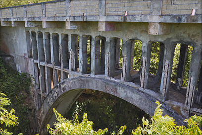
Continuing east, down Calle (street/double ‘l’s are silent) La Estacion, it eventually becomes Calle Panoramica. About the time it looks like it ends, you will see the old concrete railroad bridge built in 1922… referred to by locals as Puente Blanco.
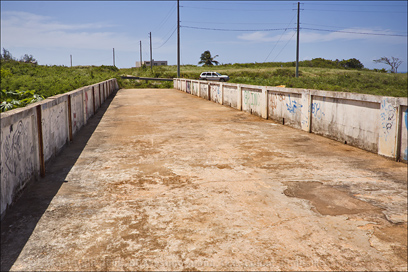
At this point, Google Maps would have you believe you could continue on across the bridge, but this is simply not the case.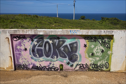
We stopped and took lots of shots of the decaying, abandoned bridge and I did venture to the other side on foot. No big deal. I’m sure it would still support most cars… just not heavy steam engines. It looked pretty bad underneath.
This is where I got the shots of the green ‘Sea Grapes’. Turns out, these can be made into wine or vinegar for cooking. Who knew? The abandoned bridge is more for history buffs than the average tourist as there is nothing here to explain what went on, way back when.
On to Puerto Hermina-
We backtracked to Calle Cuesta Española and took it over to Highway 4484 going east. This eventually intersects Highway 485 which we took east as well. About 3/4 of a mile down 485 is the turnoff onto Highway 4485. 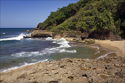 This is an easy road taking you past a nearly finished apartment complex on your left.
Right after that, the road takes a steep, blind hairpin turn to the left.
Once you clear the hairpin turn, it’s not so bad and you have great views of the coast again. This area has been turned into a formal picnic area so I’m sure it’s quite popular on the weekends. There is a small parking lot at the end and a very short walk to the old stone building of Puerto Hermina
As legend goes, this was a popular hangout for pirates.
There is a tiny beach next to the structure with small caves everywhere you look. Lots of places to hide your ‘booty’.
Most of the shoreline in this area is very rocky with lots of crashing, breaking waves.
We backtracked to Highway 485, taking it east towards Camuy. Eventually, Highway 485 will parallel the coast again.
As with Isabela, there is much we did not see in Quebradillas. I’m always open to ideas… places to visit, we have not seen yet. What are your favorite spots?
Roberto, the Scurvy Dog… ARRG!
There was only room for some of the shots I got. Many more and larger ones can be seen over on me Scurvy FaceBook page. Check it out!

Leave a Reply