Bosque Seco De Guánica,
An International Biosphere.
This destination was on my original hit-list…
The 10,000 acre Reserve is home to over 600 species of plants and animals including 48 endangered species of which 16 are endemic to Puerto Rico (per Wikipedia).
Trivia/History- Guánica’s large enclosed bay on the Southwest coast is where the US first invaded Puerto Rico during the Spanish-American War of 1898. This landing gave them a foothold to proceed overland to Ponce, then onto Coamo where the fighting ended.
The Road Trip-
We took Highway 2 out of Ponce to Hwy 116, then Hwy 334 up to the formal site of the reserve. Its pretty much a straight shot. Once you go through the main gate, the road drops to a ‘wide’ single lane, freshly paved road. You literally have to drive into the shoulder to pass cars going the other way. The road ends at a large parking lot with a small visitors shack.

We stopped at the shack where there were 3 guys siting around shooting the breeze. No information was volunteered other than the suggested ’45 minute’ walk. We did not score a map of the area until we asked for one after having completed our little trek which took closer to an hour and a half to complete. The Camino Los Granados was a little over 2 miles long and looped back to the parking area. I have to say, it was the worst hike I have done since I got to PR. This particular trail was covered in sharp rock and boulders from start to finish. Because of my funky ankles, I wear lightweight hiking boots everywhere I go. Thank God for small favors.
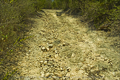 There were a couple of easy stretches, but most of it was a real disaster. To make matters worse, there was no cover or rest areas along the route except for one picnic table, very near the beginning of the trail. I cannot speak to the other 34 miles of trails in the system, but this one was a total wreck! I’m not out of shape per se, but you would need to be in relatively good shape to appreciate this ‘hike’, especially when you consider its over 90F with no shade, what so ever. The path itself takes you through mostly heavy over growth and thick brush with little to see beyond that.
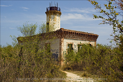 I had hoped to shoot some of the local birds, but that would mean hanging in one spot for a couple hours and that was not going to happen. I could hear them, but not see them. Much of what I read on-line about this EcoTourist hot-spot is that its great for biking… I would NEVER subject my mountain bike to what I saw. Dodging boulders and ruts carved in stone is not my idea of a good time. Its obvious to me, that this tourist destination was ‘let go’ and is in very bad need of serious maintenance. There was evidence of work being done to plant more trees along the paths, but that will not help the truly trashed trail I encountered.
 I think this place would make a fantastic 4 wheeler and dirt bike park, but its designation as a reserve prevents that. At least you would be able to get around in it better. Maybe rent golf carts by the hour?
The other suggested trail up to the stone lookout is something I may check out on another trip, but I’m not optimistic about it. I do plan to eventually come back and walk the Camino Dinamita trail down to the shoreline as it should present more diversity. The problem with it is, it’s really a one way hike for folks over 50 like me. I will have to arrange for a ride at the other end.
At this point, I could only give the Dry Forest Reserve
a 2 out of 5 skull rating
Fortunately, the rest of the reserve was much more interesting. Its easy to think of this park as divided into 2 parts. The first being the area I just visited and the second being the part that skirts the shoreline.
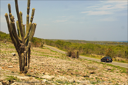
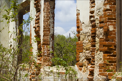
To access this 2nd part, you head back out to Hwy 116, take a left and turn onto Hwy 333 which bypasses the town of Guánica. This road will take you back into the Reserve. Hwy 333 drops back to a wide single lane road at that point. It climbs the hills with good views of the bay before heading back down to the shore. The highlight of the trip for me, was the beautiful abandoned lighthouse. Its still standing, but suffers from spray-painted graffiti. There are plans to restore it. That would be very cool. I plan to come back to it and spend more time shooting it in detail.
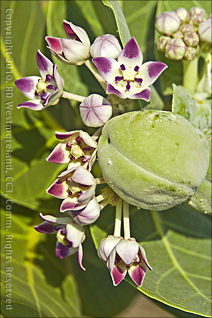
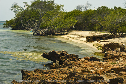 The shoreline is a mix of sharp rock outcrop with small sections of sandy beaches and mangroves hanging at the water’s edge. Up the hills were scrub and cacti as I had expected to see. Something else worth mentioning is the Milkweed growing everywhere. These monster size plants produce seed pods twice the size of your fist. The 10 mile stretch of beaches and road are peppered with small pullouts making it very convenient to stop and check out the place. This area is quite popular with the locals. No huge crowds (on a Monday), but enough traffic to feel safe. Besides hanging out at the beach, there is snorkeling and fishing too. I plan to come back here to try out my underwater camera gear.
There is a huge formal beach area, Caña Gorda, but its not open on Mondays and Tuesdays so I missed it on this first run. From the outside, it looked like it had everything, restrooms, showers, food kiosks.. the works. Also located in the same area is a large hotel and spa along with a couple of local restaurants.

The end of the road is a dirt parking lot at Tamarindo Beach. A great place to spend the day with friends and family kicked back, drinking a cold one.
I never saw any reference to the limestone caves mentioned elsewhere on the Net. The black and white map we got has one trail marked as “Cuevas” off the coast so I may have simply missed it.
I can say it was worth the trip. The weather was hot, but dry.. most comfortable. I will be back. I still need shots of birds and fish and flowers and such. I would have given the Reserve 5 skulls were it not for the 1st part of my trip. Arrg!

[…] had complained about the Dry Forest of Guánica not having any places to sit down and take a break and neither does […]